Another Warm and Wet Month
By Russell Russ
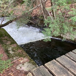
August’s weather for Norfolk was greatly affected by hurricanes and tropical storms. Not storms that made Connecticut landfalls, but storms that struck in the Gulf Coast region and just to our east in Rhode Island. The remnants of these once dangerous storms mostly lost their punch by the time they made it to our state, but they still brought considerable rain to the region. There was little wind damage here, but the rain seemed relentless and there were flooding concerns. August had an abundance of cloudy, but also humid days. No record high temperatures were set this month. Overall, it was warmer than normal and like July was wetter than normal.
August’s low temperature of 49 degrees was observed on August 1 and the high of 89 degrees was observed on August 12. The monthly mean temperature of 69.8 degrees was 3.4 degrees above normal. It did not seem like it was that warm, but this August was Norfolk’s 6th warmest August over the last ninety years. Norfolk’s warmest August on record was in 2001 with a temperature of 71.0 degrees. The coolest August on record was in 1964 with 61.5 degrees.
The total precipitation recorded for the month was 6.33 inches, 1.73 inches above normal. This August was Norfolk’s 11th wettest August on record. Norfolk’s wettest August, and wettest month of any month, was in 1955 with 23.67 inches. One cannot write about August rainfall totals without mentioning The Flood of ’55 that hit this area so hard back in August 1955. Norfolk’s driest August was in 1953 with just 0.65 inch, which was also Norfolk’s fifth driest month of any month. The month of August can have big swings for precipitation amounts. What we experienced this summer was that not only can hurricanes and tropical storms (or the lack of them) really affect our summer rainfall totals, but the remnants of these storms can also play a large role.
Through August, the total precipitation amount for the year was 39.78 inches, 5.43 inches above normal. By comparison, this was 15.27 inches more than last year’s total through August. The summer of 2020 was a dry one. The summer of 2021 has been the opposite. Last summer the talk was all about the drought, this year it is all about the excessive rainfall.
September brought more of the same for weather in Northwest Connecticut. Remnants of another hurricane that made landfall in the Gulf Coast dumped 4.34 inches of rain on Norfolk during the first two days of the month. It was then fairly dry for a few weeks until a slow moving cold front produced 3.28 inches of rain in a short period of time. Both measurements were 24-hour rainfall totals. That is impressive. By September 25, the monthly rainfall total of 8.52 inches was already 3.85 inches above normal. Another wetter than normal month for Norfolk. Through two-thirds of the month, temperatures were running on the warm side and there was no talk of frost. Yes, frost can occur in September in the Norfolk area. Fall foliage was quite noticeable by mid-September. The sugar maples seem to be having an off year, likely due to the excessive rainfall. The leaves have begun their color change and it will not be long before the weather finally follows suit and turns more fall like.