Third Warmest Month on Record
By Russell Russ
The month of July is typically Norfolk’s warmest month of the year and this July certainly lived up to that. There have been only two months over the last eighty-eight years that have been warmer than this July. While it was a very warm month with an abundance of humidity, it came in quite low for rainfall. Summertime warm and humid air often produces thunderstorms and heavy rainfall. We got that last July, but this July the big rains, while hitting many other parts of the state and region, did not hit Norfolk.
July’s high temperature of 90 degrees was observed on July 20 and 21. Both days missed record daily highs by just one degree. These were the first and only days so far this year when Norfolk hit 90 degrees or above. It was a very warm month with numerous days coming close to daily record highs, but there was just one day that actually hit a record. The high of 89 degrees on July 17 tied the 1968 and 2012 high for that date. The low temperature of 54 degrees was observed on July 25. July’s monthly mean temperature of 71.9 degrees was 3.7 degrees above normal.
This July was Norfolk’s third warmest July and third warmest month of any month over the last eighty-eight years. Norfolk’s top three warmest months on record are July 2013 with 72.7 degrees, July 1955 with 72.1 and July 2019 with 71.9. July 2018 with 71.5 degrees is tied with 2010 as Norfolk’s fifth warmest month. Norfolk’s six warmest months on record have all been in July. Norfolk’s coolest July occurred in 1962 with a monthly mean temperature of 63.9 degrees. The second coolest July was in 2000 with 64.4 degrees.
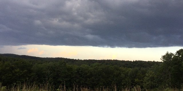
The total precipitation recorded for the month was 2.81 inches, 1.55 inches below normal. This July ranked as Norfolk’s twentieth driest July on record. Comparing this July to last July, this year saw 3.55 inches less rainfall than what was recorded for July 2018. The bigger storms may have hit Norfolk last year, but they missed town this year. There were four thunderstorms observed at the weather station, but none were severe in nature. The storm during the afternoon of July 22 produced 1.71 inches of rainfall, the largest of the month. Norfolk’s wettest July was in 2014 with 12.76 inches, the driest was 1939 with 1.29 inches.
Through May we were doing quite well for yearly precipitation. June and July were both below normal. Through July the total precipitation amount for the year was 27.66 inches. This was 2.20 inches below normal. We are now in a deficit and it is becoming noticeable in local lake and pond levels – and lawns. While we are a little below normal, it is no reason for great concern since this amount could easily be reversed with one or two rain events. If the deficit continues for several more months then it will be a bigger concern. We are far from record dry conditions.
An early look into August, through mid-month, showed that August’s weather was quite pleasant overall. Typical August summertime weather for Norfolk. There were some humid days, but it is August so that is normal. The warmest temperature through August 17 was just 82 degrees. Rainfall was about normal. Autumn is just around the corner. As is usually the case by mid-August, there is a faint sign of fall coloring showing up in some trees and several mornings have dipped into the low 50 degree range. Enjoy the summer heat while it is here. It will not be long before autumn arrives.