Managing our woodlands in the age of invasive plants—research at Great Mountain Forest
October 9, 2026
Rebecca Dowling
Explore how researchers are monitoring invasive plants to prevent their introduction and control their spread
New England’s forests are increasingly under siege from a number of human-caused disruptions, such as a changing climate, herbivore overpopulation and overbrowsing, development pressures, new tree diseases, and, of course, invasive plants.
None of these phenomena work alone—for instance, milder winter temperatures have allowed cold-sensitive pests and plants, such as the hardy but warm-weather-loving Japanese barberry (Berberis thunbergii), to encroach further north. Additionally, white-tailed deer preferentially browse native plants, leaving room for invasive shrubs to move in. Taken together, these converging threats may cause rapid change in the forests of the Northeast, which have lived in relative stasis for 10,000 years.
GMF’s status as a community demonstration forest allows scientists and stewards to tackle these difficult topics in ways that can be complementary. As invasive plants such as Japanese barberry expand their range and intensify their cover, it has never been more important to understand the dynamics of these forest invaders through research and how to protect the native plants they crowd out through active management
What is Japanese barberry?
Like many of North America’s most widespread non-native invasive plants, Japanese barberry was introduced as an ornamental plant in the late 19th century. It’s a highly adaptable spiny bush that tolerates shade well, meaning it often outcompetes native plants and shrubs vying for precious sunlight on the forest floor.
It’s an aggressive bush that spreads itself clonally through underground rhizomes once it takes hold. “That causes a very dense thicket that prevents tree saplings and other plants from growing because they’re now being shaded or choked out by the branches of Japanese barberry,” said Kellen Moore, a post-graduate researcher at the Yale School of the Environment who has worked extensively with the plant within Great Mountain Forest.
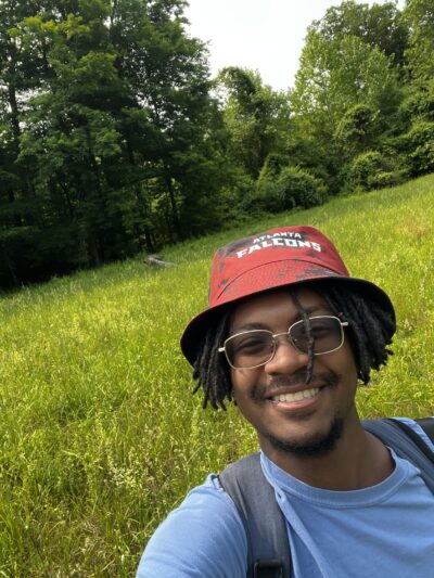
Post-graduate researcher Kellen Moore at the Yale School for the Environment is one of several scientists using GMF as study sight to develop better mapping tools for forest managers to control invasive species like Japanese barberry.
Where it becomes extensively established, Moore said, “you end up with a sort of grassland area that’s mostly large bushes of barberry, but no trees… [creating] these holes in the forest that are just nothing but barberry.” This pattern is particularly common on sites with a history of human disturbance such as old farmsteads that have returned to forest cover.
Beyond restructuring the forest ecosystem, invasive shrubs can also have unexpected cascading impacts. GMF Trustee Jeffrey Ward, who is also chief scientist emeritus at the Connecticut Agricultural Experiment Station, said that there is a well-established connection between Japanese barberry and Lyme disease: “One of the things when we were working with barberry was we noticed an incredible amount of ticks crawling all over us!” This pattern was linked to the increased humidity levels that occur in very dense thickets of barberry.
Further, Japanese barberry monocultures tend to host large populations of nonnative earthworms, which devour surface leaf litter and organic matter, replacing the surface soil (humus) with castings (digested material), which are easily washed away by rain. “So we get a thunderstorm,” Ward said, “and we’re seeing sheet erosion and gullies forming, and then that ends up impacting riparian [riverside] areas.” This process depletes the thick organic layer that is typical of our forest’s surface soils and which is responsible for retaining moisture, supporting soil biota, and supplying plants with nutrients.
Mapping barberry for forest managers
For invasive management, prevention is everything—“It’s easier to keep them out than to control them once they’re in,” according to Ward.
That’s what inspired Moore to develop his own project to produce a predictive mapping tool designed to help forest managers in Connecticut identify and monitor locations at a higher risk for Japanese barberry infestations.
“For Connecticut specifically, we are in kind of like the Goldilocks [zone] for Japanese barberry,” he said—too cold to the north, too warm to the south, and too dry to the west. This means land managers in the state have to be especially vigilant for the shrub. It also means that existing data, which shows the vast majority of the state as at risk for barberry invasion, is likely too coarse to inform targeted management decisions at the local level needed by landowners and stewards
Moore based his research on a tool developed by the United States Geological Survey (USGS) called the Invasive Species Habitat Tool (INHABIT), which maps where invasive species may become abundant on the landscape. Moore said his goal is to supplement the USGS data with maps more specifically tailored to Connecticut’s environmental features.
GMF was one of four sites where Moore conducted his field research during the summer of 2025, mapping plots where Japanese barberry grew and comparing its abundance with various landscape features, such as slope, soils, proximity to roads and others.
“[We used] those to create a predictive model based on how likely it is that another area with these sorts of environmental conditions may have a certain percent coverage,” he explained.
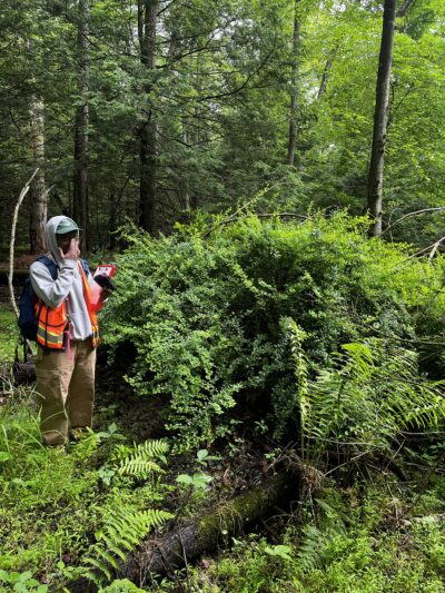
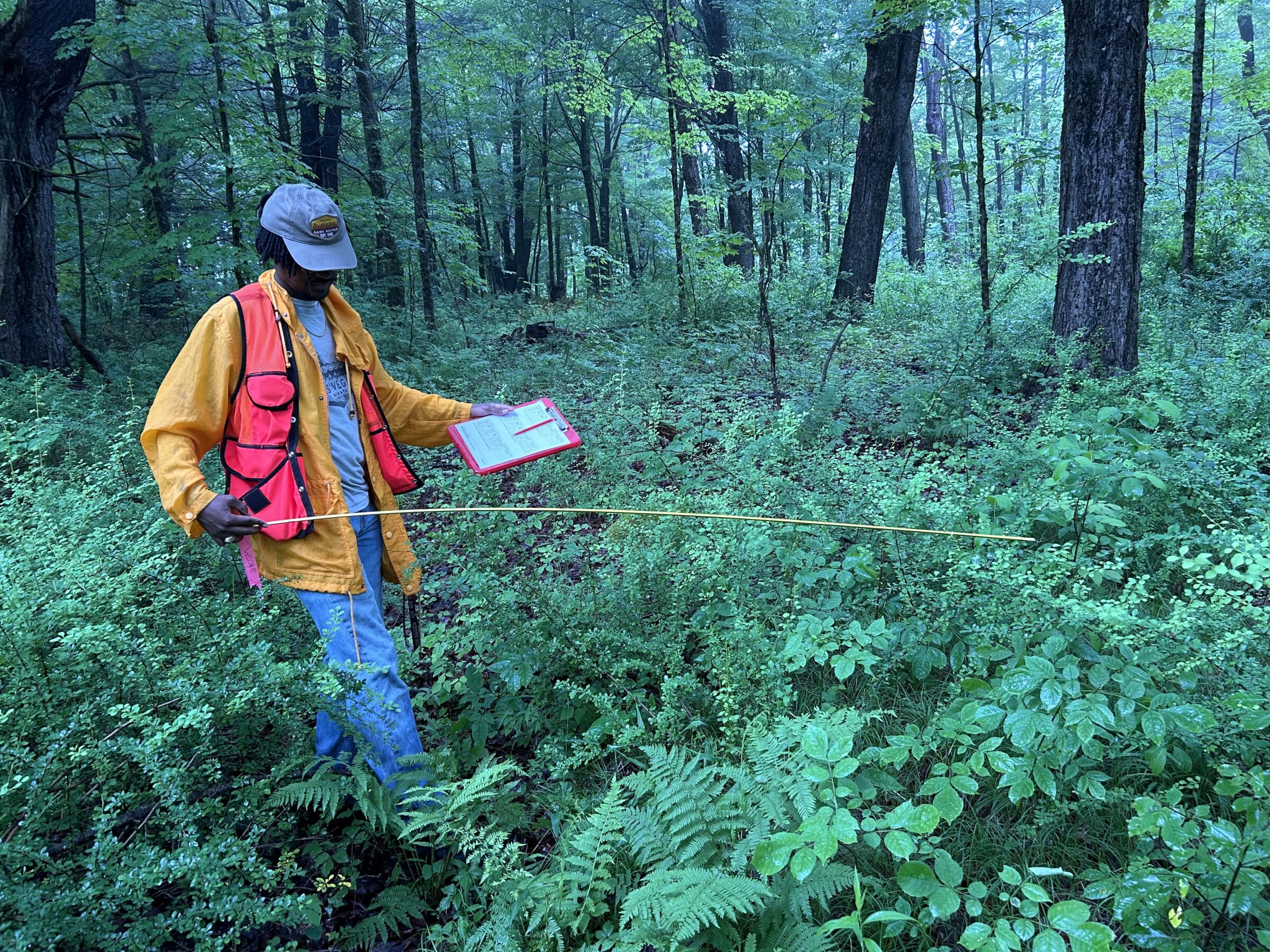
Moore and his intern, pictured above, spent many hours combing the forest floor for the persistent shrub, which grows in dense thickets that eventually crowd out any other plant nearby.
Moore said that GMF’s diverse landscape with rugged terrain, dense core forest, and many different habitats alongside human features like active roadways and trails, offered his study a useful breadth of data. “It gave us a lot of different conditions to assess the distribution of Japanese barberry that honestly we might not have had the opportunity to do in a lot of different places,” he said.
Plus, there was the added benefit of staying a few stints at Yale Camp’s researcher accommodations while conducting his field work. These facilities are owned by Yale Forests, but managed by GMF’s team.
Having physical research locations will be essential as invasive plants expand across the region, even as other monitoring technologies aid the process, Moore said. “Personally, it’s a very intimate relationship with the forest to go out and really get to just see… all the dynamics that create a forest.”
Monitoring from above
As the problem of species invasions expands, additional monitoring methods may be needed. Hannah Nyarko, a fellow Yale researcher currently pursuing her Master’s degree, is taking a different vantage point, using remote sensing methods to map distributions of “problematic” species on the ground and, like Moore, model where they might next show up.
“When it comes to working on a very large area,” Nyarko said, “traditional [monitoring] methods can be time-consuming, labor-intensive, and costly.”
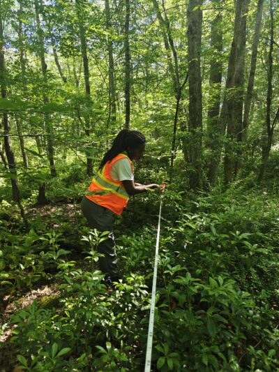
Yale School of the Environment Master’s student Hannah Nyarko is studying how to use remote sensing methods to identify problematic understory plants. Part of that research was confirming satellite data with observations on the ground at GMF.
Nyarko uses a combination of multispectral and LiDAR imagery to identify where specific species may be found on the ground, and then ground truths the data with field observations.
One of her focus species is Japanese barberry, which she spent a week studying at GMF this past summer. She said that by combining field observations with remote sensing (satellite) data, the research will help identify which environmental factors make certain areas more likely to be invaded.
This type of analysis is essential to responsible management, Nyarko said, especially in a time when invasive plants are converging with other emergent human-driven threats.
“Forests aren’t static environments,” she said, “you have new species moving in, species moving out… Your plans should be able to be dynamic, and they should change as the forest keeps growing.”
Being dynamic means viewing the forest from a variety of vantage points, Nyarko maintained. “[Remote sensing] is not supposed to replace traditional methods, but rather to complement them,” she said, “because at the end of the day, you need to be able to validate whatever thing your remote sensing data is telling you; you need to be in the field to determine that whatever I’m seeing on my image is really what’s on the ground.”
GMF Forester Kate Regan-Loomis said this type of work will aid forest managers like herself in identifying strategic locations to manage, combat and, ultimately, prevent invasive spread. “I don’t know anyone who really views elimination for any invasive plant as a reasonable goal on their property,” she said, “because at the end of the day, people can’t control what their neighbors do [to prevent or weed out invasives].”
“Work like what [Moore and Nyarko] are doing where mapping technology is getting better helps us come up with priority areas,” Regan-Loomis said.
Jeff Ward, who just taught a Woodland Academy course on managing forests against invasive plants, has a similar philosophy. “You’re never going to eliminate invasives… that’s an unrealistic goal,” he said. “So right now, the strategy is just to maintain the native species that we have.”
About the Author
Alec Linden is a news reporter, environmental storyteller, and researcher based out of Norfolk. After completing a master’s degree in environmental governance and policy at the University of Oxford in 2023, Alec moved back to the Northeastern US to begin a career caring and advocating for the hills, ravines, and rivers that he cherished growing up in downstate New York. Alec relocated to the Northwest Corner in the summer of 2024 to become a reporter with the Lakeville Journal, and now helms newsletter and copy editing duties for GMF. During his down time, Alec spends as much time as possible on skis, and in the warmer months pokes around the woods of the Berkshires and Taconics to search for new rock climbing routes.