
PREVIOUS WEATHER REPORTS
February 2013
Winter is Back
By Russell Russ
Old Man Winter has not forgotten Norfolk after all. February turned out to be a more normal winter month than what we have seen lately. It was just a little warmer than normal, but snowfall was nearly six inches above normal.
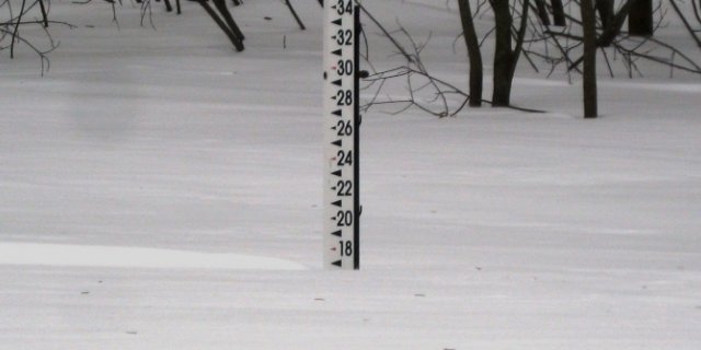
There were a good number of days with a little snow, but the clincher was the blizzard that hit on February 8 and 9. While it was a bigger snow producer just to our east and south, it still left Norfolk with a 17 to 24 inch blanket of snow. It turned out to be a very interesting event in that the snow totals varied greatly over relatively short distances due to the heavy bands of snow that quickly dumped snow in one location while just a few miles away there was considerably less.
Hard to believe there could be a 10 inch snowfall difference in such short distances, but that is exactly what happened. Snowfall totals from some areas in southern Connecticut topped 3 feet. We better hold off on giving winter its last rites, it appears to not want to let go that easily.
February’s high temperature of 46 degrees was observed on February 15 and the low of 5 degrees was observed on both February 10 and 18. No daily or monthly records were broken this month. With an average temperature of 23.8 degrees it was 1.9 degrees warmer than normal. The month of February is typically when we get most of our lowest temperature readings. We did not slip below zero this month, but we did manage to get to 10 degrees or colder eight times. Last year, February 2012, was the second warmest February in our 81 year history.
The total precipitation recorded for the month was 3.69 inches, 0.05 inch above normal. The monthly snowfall total was 26.2 inches, 5.8 inches above normal. A good portion of the monthly snowfall came from the blizzard on February 8 and 9, and most of that came during the early morning hours of February 9. Last year, February 2012, was our second driest February on record and was also tied with 1941 as our third least snowy February on record.
The 2013 calendar year (January and February) snowfall total of 33.8 inches is 7.9 inches below normal. The snowfall total for this winter season, October through February, is 55.7 inches. This is 10.8 inches below normal for this time period, but it is 11.4 inches more than last year.

January 2013
The New Normal?
By Russell Russ
The first month of 2013 picked up right where 2012 left off. It was another warmer than average month. January on average is our coldest and snowiest month of the year. Our winter did finally seem to begin with some colder temperatures this month, but the typical Norfolk snowfall continued to elude us.
Many adults remember the good old winter days when we got “tons” of snow and when it was “always” in the single digits or even colder. The teenagers of today have only heard about how warm it is and how little snow we have. The big snowstorm and really cold temperatures do still come, but they are few and far between these days. It seems like the new normal for Norfolk’s wintertime will be less snow and warmer temperatures.
With an average mean temperature of 24.0 degrees January was 3.3 degrees above normal. It was warm, but not even in the top ten for warmest. The warmest January continues to be January 2002 with an average mean temperature of 32.4. The month’s high temperature of 57 degrees was observed during the early morning hours of January 31. The low temperature of minus 5 degrees, our coldest temperature of the season so far, was observed on January 24. In adjacent towns and other parts of Norfolk there were reports of minus 10 to minus 12 degrees on that morning. At the weather station so far this winter we have dipped below zero on just one day.
Tobey Pond and Wangum Lake froze over for good on January 2. For Tobey it was one week earlier than last year and for Wangum two weeks earlier than last year. With colder temperatures and little snow the conditions were good for skating and ice fishing on most local ponds.
January’s total precipitation amount was 2.05 inches, 2.01 inches below normal. The monthly snowfall total of 7.6 inches was 13.7 inches below normal. The snowfall total for this winter season to date, October through January, is just 29.5 inches, 16.6 inches below normal.
On January 25 around noontime a beautiful halo appeared around the sun. This type of halo, called a 22 degree halo or a 22 degree circular halo is not all that uncommon. They are beautiful to see in person, but are very difficult to photograph. Sunlight hitting ice crystals in high, thin cirrus clouds produces the visual affect which often times, but not always, means a front is moving in that will soon bring precipitation. In this case we did pick up a half inch of snow later that evening.
