
PREVIOUS WEATHER REPORTS

December 2018
Norfolk’s November & December Weather & a Yearly Summary for 2018
By Russell Russ
The year of 2018 was a wet one and the months of November and December were also above normal for precipitation with both months adding to our yearly surplus. The previous three years were all below normal for precipitation, but 2018 ended that – and then some. The conclusion of 2018 completes 87 years of continuous weather observations at the Norfolk 2SW weather station.
November’s average temperature of 34.1 degrees was 3.0 degrees below normal. Temperatures ranged from a high of 64 to a low of 3 degrees. Precipitation for the month totaled 8.65 inches, 4.06 inches above normal. It was Norfolk’s 5th wettest November on record. The monthly snowfall total of 12.9 inches was 6.3 inches above normal. It was tied with November 1940 as our 15th snowiest November on record. The first measurable snowfall of the season came on November 15-16 when we received a total of 8.5 inches. There were two record daily temperatures in November. The low of 4 degrees on November 22 tied the 1987 record and the low of 3 on November 23 surpassed the old record of 7 set in 1932.
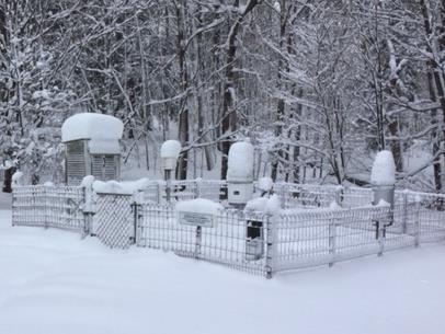
December’s average temperature of 28.7 was 3.0 degrees above normal. Temperatures in December ranged from a high of 59 to a low of 11 degrees. It was tied with 1999 as Norfolk’s 14th warmest December. With a total precipitation amount of 4.69 inches, it was just 0.16 inch above normal. December’s monthly snowfall total of 4.4 inches was 12.6 inches below normal and ranked tied with 2014 as Norfolk’s 7th lowest December monthly snowfall. The high temperature of 59 on December 21 tied the 2013 record high temperature for that date. December was a cloudy, raw and damp month with little snow, more like a cold November than a December.
With the colder than normal November temperatures, many smaller local ponds were ice covered as early as November 16. Tobey Pond was ice covered on December 5 and stayed iced through the end of the month. Wangum Lake iced over in mid-December, but opened up later in the month and as of late December still was not iced for the season. These ice-in dates are about normal to perhaps a little earlier than normal. It was a close one, exactly like it was in 2017, but a Christmas Eve evening light snowfall solidified a White Christmas for Norfolk. Probably not for most of the rest of the state, but Norfolk just barely got one once again. Technically, one inch of snow on the ground makes for a White Christmas.
Norfolk’s weather for 2018 will be remembered as being very wet and kind of warm. It had its moments, a lot of snow early in the year, many warm temperature days and a lot of rain during most months, but for the most part there were no major or devastating weather events during the year for Norfolk. Seven out of twelve months were above normal for temperature, nine out of twelve were above normal for precipitation and four out of eight winter season months were above normal for snowfall. Throughout the entire year there were many high ranking months for temperature, precipitation and snowfall. A majority of the high ranks were due to warmer than normal monthly temperatures. Notable months were February for being the 3rd warmest, March for being the 4th snowiest, May for being the 2nd warmest, July for being tied as the 4th warmest, August for being the 2nd warmest, and November for being the 5th wettest.
The coldest day of the year was January 7 with a low temperature of minus 10 degrees. There were five days in 2018 with temperatures of zero or below zero (three were below zero). The warmest days of the year were July 1 and 2 when both reached the 92 degree mark. In total, there were three days in 2018 that recorded temperatures of 90 degrees or above. The yearly mean temperature was 46.5 degrees, 1.6 degrees above normal, ranking it as Norfolk’s 11th warmest year over the last 87 years. Last year was tied as 10th warmest.
The yearly precipitation amount of 66.97 inches was 14.45 inches above normal, ranking it as Norfolk’s 7th wettest year over the last 87 years. This is 21.14 inches more than last year, which ranked as Norfolk’s 19th driest year on record. No talk of precipitation deficits in 2018.
Snowfall for the 2018 calendar year totaled 108.4 inches, not very high ranking for yearly snowfall, but it was 18.6 inches above normal. January, February, April and November gave us good snow totals, but we can thank the month of March most of all since that month alone was 26 inches above normal for snowfall.

October 2018
An Average October
By Russell Russ
Many recent months have been high ranking for temperature or precipitation, or both. Something we have not seen much of lately is an average weather month, but that is just about what October was. The month started out warm with some late summer-like weather. That all changed by the second week of the month when temperatures dropped back down to normal and even below normal. The fall foliage season peaked about a week or two later than normal. This followed the trend we have seen for the last several years. Our normal peak is being extended a week or two beyond what we used to call our peak foliage time. Arguably, it was not one of our finer foliage seasons around here.
The month’s high temperature of 77 degrees was observed on October 10. The low temperature of 27 degrees was observed on October 19 and 31. The monthly mean temperature of 47.7 degrees was exactly normal for October. Being exactly normal does not happen often. Norfolk’s warmest October was in 2001 with 55.3 degrees. The coldest was in 1974 with an average temperature of 42.0 degrees. There were about seven days with frost in the area. There were four days with frost at the weather station, the first was on October 18.
The total precipitation for the month was 4.55 inches, just 0.28 inch above normal. Not much above normal, but it was yet another month this year with above normal precipitation. Norfolk’s wettest October was in 1955 with 17.28 inches and the driest was in 1963 with just 0.63 inches.
Through October, the total precipitation amount for the year was 53.63 inches. This was 10.23 inches above normal through the month of October. With still two months to go to finish off the year, Norfolk was 1.11 inches above our normal yearly precipitation average of 52.52 inches. With just a trace of snow and sleet on four days, the monthly snowfall total was just a trace. This is 0.9 inch below normal. For the 2018 calendar year through October, we are currently 24.9 inches above normal for snowfall – and we still have two months to go.
Through November 20, temperatures for November were running about normal and with 6.96 inches of total precipitation, Norfolk was already 2.37 inches above the average amount for the entire month – with ten days still to go. The season’s first measurable snowfall came on November 15 and 16 when Norfolk received a total of 8.5 inches of heavy wet snow. While it was a shock to everyone that winter was coming, it was not any kind of November snowfall record for Norfolk. What might be record setting are the low temperatures predicted for the time around Thanksgiving. Single digit temperatures are in the forecast.
November is typically the transition month into winter for Norfolk and it happened again this year. After a relatively warm first few days, giving us one last taste of autumn, the temperatures then turned down to be much more typical for November. With ten days still to go, November seemed so very cold and snowy, but in reality it was just about normal. Perhaps we all have forgotten what normal really is.

September 2018
Warm and Wet
By Russell Russ
September weather in Norfolk this year was mostly cloudy and humid for much of the month. Temperatures and rainfall were both well above normal. September is prime Hurricane season. North and South Carolina were hit with devastating rainfall totals when Hurricane Florence made landfall September 14. Remnants of Florence did produce 2.61 inches of rain here September 17-18, a decent amount of rain, but no widespread damage or flooding here, as was the case in the Carolinas. Our prolonged summer persevered through the month. It was not until the latter weeks of the month, when the foliage finally began to turn, did we realize that autumn in fact was on the way.
September’s high temperature of 88 degrees was observed on September 6 and the low of 41 degrees was observed on September 30. The average mean temperature was 62.4 degrees, 3.5 degrees above normal. During the first week of the month there were several days with record setting or near record setting high temperatures. The September 5 high of 85 tied the 1983 record and the September 6 high of 88 just beat the 1943 record of 87.
This September was tied with 2010 as the seventh warmest September over the last 87 years. The warmest September was in 2015 with 64.7 degrees and the coolest was in 1963 with 53.6 degrees. For the year, there have been six months above normal for monthly temperatures and September made it five in a row. We will have to see how the last quarter of the year plays out, but 2018 could be in the running for a high ranking among warmest years on record for Norfolk.
The month’s rainfall total was 8.77 inches, 4.12 inches above normal. It was Norfolk’s fourth month in a row with above normal rainfall. In fact, six of the nine months this year have been above normal for precipitation. It was the ninth wettest September over the last 87 years. The wettest September was in 1938 with 13.40 inches (thanks to the Hurricane of ’38). The driest was in 2014 with just 1.16 inches.
Through September this year, the total yearly precipitation amount was 49.08 inches. This is 9.95 inches above normal. Through September, we are only 3.44 inches away from Norfolk’s average amount for the entire year. By comparison, at this point last year we were 5.53 inches below normal and two years ago we were 11.04 inches below normal. No talk of precipitation deficits around here this year, that is for sure.
What will October’s weather be like? By two-thirds of the way through the month as Norfolk Now was going to print, it was a tale of two weather months. Through October 11 it was more warmth and more rain – just like it has been all summer and early fall. But, the weather turned here after that and cooler temperatures began to take over. Changing leaf colors and several days with frost after mid-month shocked everyone with the realization that summer is finally over. Historically, frost is common in September around Norfolk, but for the last few years it has not shown locally (for the most part) until October. As is typical, October was our transition month. In recent years the colder weather seems to have been somewhat delayed, but there is no holding back Mother Nature. Winter is on the way.

August 2018
More Heat and Humidity
By Russell Russ
August continued our summer of heat and humidity here in Norfolk. It was another hot and humid month with above average rainfall, kind of like it has been all summer long. If you like your summers hot then this year was your year.
August’s low temperature of 52 degrees was observed on August 24. The month’s high temperature of 88 degrees was observed on four days, August 6, 7, 28 and 29. The high of 88 on August 6 tied the 1955 record high for that date. Temperatures were very near record levels on August 7, 8, 28 and 29. The monthly mean temperature of 70.9 degrees was 4.6 degrees above normal. This August was the second warmest August in the last 87 years, very near the August 2001 record of 71.0 degrees. It was also tied with July 2016 and July 1994 as the seventh warmest month of any month since 1932. The coolest August on record was in 1964 with 61.5 degrees.
The total precipitation recorded for the month was 5.70 inches, 1.07 inches above normal. It ranks as Norfolk’s sixteenth wettest August on record. Not all that impressive, but it did continue our recent trend of months with above average monthly rainfall. Norfolk’s wettest August (by far) was in 1955 with 23.67 inches, the driest was in 1953 with just 0.65 inches.
Through August, the total precipitation amount for this year was 40.31 inches. This is 5.83 inches above normal and is also over 10 inches more than we received through August of last year. Compared to the last several years, this year seems like it should be working on some kind of record, but we need to remember that the last several years have all been on the low to very low end of the yearly rainfall spectrum. We also have four more months to go to close out 2018.
What will September’s weather bring to Norfolk? Through September 19 it was just a continuation of the warm, humid and wet weather that we have seen all summer. Temperatures were running over 7 degrees above normal and rainfall already was 5.12 inches, almost a half inch above the monthly normal. Remnants of Hurricane Florence hit Norfolk with 2.61 inches of rain on September 17 and 18. Heavy rainfall in Norfolk for a while, but the rainfall totals were nowhere near what North and South Carolina received when Florence made landfall there. Some foliage began to turn by early in the month, but for the most part everything remained very summer like into the third week of the month. Eventually fall will be upon us.

July 2018
Fourth Warmest Month on Record
By Russell Russ
July was a wet and very warm month. Compared to more urban locations, Norfolk typically sees cooler summer temperatures. Norfolk’s forested landscape and higher elevation plays heavily into this cooling influence. Sometimes though, the heat and humidity during the dog days of summer can overtake Norfolk’s somewhat protected little weather world. That was certainly the case in July when we saw hazy, hot and humid conditions for much of the month. The tropical air also resulted in above average rainfall.
July’s high temperature of 92 degrees was observed on July 1 and 2 and the low temperature of 48 degrees was observed on July 7. There were three days this month with record daily high temperatures: 92 on July 1 (was 90 in 1934 and 1964), 92 on July 2 (was 91 in 1934) and 89 on July 16 (tied record from 1969). In addition to these, heat records were nearly broken on July 3, 4, 5 and 17. July’s monthly mean temperature of 71.5 degrees was 3.4 degrees above normal.
This July was tied with 2010 as being not only the fourth warmest July on record, but also tied as the fourth warmest month of any month on record (since 1932). Quite impressive to think that there have been weather observations made for 1,039 months at this weather station and July 2018 was tied as the fourth warmest of all of those months. Norfolk’s warmest July on record was in 2013 with 72.7 degrees, the coolest was in 1962 with 63.9 degrees.
The total precipitation recorded for the month was 6.36 inches, 2.02 inches above average. There were five thunderstorms this month, but nothing overly severe around here. With less than an inch of rainfall recorded through July 16, things were beginning to look dry. That changed dramatically during the second half of the month. While this July was wetter than normal it still was not even in the Top-10 for wettest. The wettest July was in 2014 with 12.76 inches, the driest was in 1939 with 1.29 inches.
We are doing quite well for precipitation this year. Through July the total precipitation amount for the year was 34.61 inches. This is 4.76 inches above average and also 7.39 inches more than the total through July 2017. For 2015-2017, Norfolk was below normal for precipitation through the month of July (also for those entire years). Even though we are doing just fine for moisture so far this year, some trees still are showing signs of stress from our previous years of drought. It can take two to three years for signs of drought to show up in trees. Our precipitation surplus this year will certainly be beneficial for our friends the trees.
An early look into August, through August 17, showed that August’s weather was looking much like our July weather. The heat, humidity and rainfall continued. Temperatures were running 6 degrees above normal and we had already seen 4.75 inches of rainfall, 0.12 inch above the normal for the entire month of August. Autumn is just around the corner. Enjoy the summer heat while it is here. It will not be long before we see cooler temperatures and even some changing leaf colors around here.

June 2018
Nice Summer Weather
By Russell Russ
June’s low temperature of 43 degrees was observed on June 4 and the high of 88 degrees was observed on June 18. With an average monthly mean temperature of 63.6 degrees, it was just 0.3 degree above normal. There were just a few really warm days in June and no daily temperature records were set. It was a pleasant weather month, very average for the month of June in Norfolk. Temperatures and humidity increased late in June and continued into early July.
This June was just about average for temperatures. Morning lows in the 40’s in June may seem a little chilly, but that is normal for Norfolk. Norfolk’s coolest June was in 1958 with an average monthly mean temperature of 58.8 degrees. The warmest June was in 1943 with 68.3 degrees.
The total precipitation recorded for the month was 5.76 inches, 0.90 inch above normal. There were just two thunderstorms this month, neither of which were on the severe side. The monthly rainfall total was certainly helped by two days (June 4 and 28) with moderate to heavy rainfall during the overnight hours.
During the summer months, short duration downpours typically make up a large part of the monthly rainfall total, and also, the lack of them can mean a dry month. The driest June was in 1988 when only 0.74 inch was recorded. Our wettest June was in 2013 with 13.38 inches.
For the first half of 2018 our total precipitation amount was 28.25 inches. Through June, this puts Norfolk 2.74 inches above normal for the year. This is also nearly 5 inches above where we were last year at this point in time. The years of 2015 and 2016 were very dry. Fortunately, it seems we have turned the tide and can worry about other things besides a looming drought. Of course, July and August could be dry, they sometimes are, but compared to recent years, this year we have a little cushion to work with.
An early look at July through mid-month shows that it certainly did warm up. Temperatures were running about 5 degrees above normal and for three days in a row (July 1-3) Norfolk recorded high temperatures in the low 90’s. It was hazy, hot and humid for sure for the first five days of July. When the dew point is in the upper 60’s it is noticeably humid. A few days with dew points in the mid to upper 70’s in early July made it very uncomfortable.
If you were looking for some hot summer weather then you got it in early July. Record highs were recorded on July 1 (92) and July 2 (92). We just missed record highs on July 3, 4 and 5. July is typically Norfolk’s warmest month of the year. We are supposed to see some hazy, hot and humid conditions in July and we have had some of that. The weather station typically gets to 90 degrees or above two to three times a year. For 2018, Norfolk can say been there done that.

May 2018
From Prolonged Winter to Second Warmest May on Record
By Russell Russ
Once again, May was Norfolk’s transition month into summer, although this year it seemingly happened in just the span of a day or two. Temperatures went from a low of 34 degrees on May 1 (with snowfall on April 30) to a high of 85 on May 2, then to a record high of 88 on May 3. After a cool and snowy April, all of a sudden it was summertime. Then, temperatures went back to normal or a little above normal for the remainder of the month with another temperature rise during the month’s last week. The weather on Memorial Day was beautiful. It is always nice to have good weather for the parades and holiday festivities.
May’s low temperature of 34 degrees was observed on May 1 and the high of 88 degrees was observed on May 3. With an average monthly mean temperature of 59.8 degrees, it was 4.9 degrees above normal. May’s monthly mean temperature was nearly 21 degrees warmer than April’s. This May was Norfolk’s second warmest in the last 87 years. The 88 degrees on May 3 (was 83 in 1942) and the 84 on May 15 (was 83 in 1932) both set daily record high temperature marks. Norfolk’s warmest May occurred in 2015 with a temperature of 61.8 degrees, the coldest was in 1967 with 46.8.
The total precipitation recorded for the month was 3.32 inches, 1.03 inches below normal. Through May, the total precipitation for the year was 22.49 inches. The last three months were below normal for precipitation, but thanks to above normal amounts in January and February we are currently 1.84 inches above normal for the 2018 calendar year.
There was no snowfall in May. Norfolk’s 2018 snowfall total through May was 91.1 inches. This was 25.8 inches above normal through May and is 1.3 inches above normal for the entire calendar year. We still have October, November and December to add to our 2018 snowfall total. The Winter Snowfall Season concluded in May and the final total for the 2017-2018 season was 107.5 inches, 17.7 inches above normal. It was not record breaking, but it was a snowy winter.
The big weather story from May was the severe weather that rolled through the Northeast during the afternoon of May 15. The strong thunderstorms that hit Norfolk produced vivid lightning, a burst of near-golf ball sized hail and nearly two inches of rain – all in little over an hour. There was some local hail damage reported, but thankfully there was minimal local wind damage. Not the case for many other parts of the state. The final official assessment was that Connecticut was hit that afternoon with straight-line wind damage, four tornados and multiple locations received severe hail damage. Additional severe reports came from eastern Pennsylvania and eastern New York. Norfolk was fortunate that day. It has been nearly 30 years since Connecticut has seen such widespread severe summer thunderstorm damage.
An early look at June’s weather through mid-month shows that temperatures were running about 2 degrees cooler than normal. There were several mornings with low temperatures in the low to mid 40’s. A little chilly for June, but a nice stretch of summerlike weather in the forecast for the latter half of the month will surely bring the monthly average temperature up. After a rainy first week it turned dry, but all in all, precipitation was about average through mid-month. It did seem to be a very good pollen year, or bad for the allergy sufferers. Perhaps the dry conditions just as the trees were ready to release their pollen this year compounded the effects. The clouds of yellow and haze in the air, mostly from pine pollen, were very noticeable June 9-12. With the pollen thankfully gone it must mean that summer has arrived.

April 2018
Prolonged Winter
By Russell Russ
April began cool and snowy and it stayed that way throughout most of the month. Warm and beautiful early spring days were few and very far between this April. It was more like winter was the unwanted guest that just would not leave the party. Late March showed signs of a possible arrival of spring, but early April snowfall dashed those hopes. Persistent and regular snow or sleet was the norm until the third week of the month. Cooler than normal temperatures lasted all through the month. March’s well above average snowfall left us all longing for spring, but as April progressed, the focus was not as much on spring, but that we just wanted winter to end.
April’s low temperature of 18 degrees was observed on April 6 and the high of 68 degrees was observed on both April 14 and 28. With an average monthly mean temperature of 39.0 degrees, it was 4.1 degrees colder than normal. There were no daily record temperatures this month, but overall this April was tied with 1965 as the sixth coldest April over the last 87 years. This was the case in much of the country this April. It was cool all over, especially in the Northeast.
Last year was Norfolk’s fourth warmest April; it was nearly 10 degrees warmer than this April. Norfolk’s warmest April was in 2010 with an average mean temperature of 49.4 degrees and the coldest was in 1943 with 36.8 degrees. Prior to this year, Norfolk’s April average monthly temperature has not been below 40 degrees since 1978.
The total precipitation recorded for the month was 4.18 inches, just 0.05 inch below normal. Through April, our total precipitation for the year was 19.17 inches, 2.87 inches above normal. No deficit so far this year.
April’s snowfall total was 10.9 inches, exactly 5 inches above normal. Above normal, but not even in Norfolk’s Top 15 snowiest Aprils. The month began with 7 inches of snow on the ground. Finally, by April 21 the snow was all gone at the weather station, sixteen days later than last year. It did not accumulate, but it snowed for a few hours during the morning of April 30. A fitting end to a cold and snowy April.
The 2018 calendar year snowfall amount of 91.1 inches is already 1.3 inches above normal – for the entire calendar year. The 2017-18 winter season (October-April) snowfall total of 107.5 inches is 18.1 inches above normal. Interestingly, just two years ago during the 2015-16 winter season, Norfolk recorded a record-setting low snowfall total of just 35.5 inches – for the entire winter season.
An early look at May’s weather through May 20 shows that temperatures were running nearly 3 degrees warmer than normal. Hard to believe since the first three weeks of the month seemed so cool and wet. Two record-setting and one near record-setting warm days certainly affected this preliminary monthly average. It snowed on Monday, April 30 and on Wednesday, May 2 it was 85 degrees. On Thursday, May 3 it was 88 degrees. Welcome to New England weather.
By far, the biggest weather story of May will be the severe storms that hit many parts of the Northeast on May 15. During the thunderstorms that rolled through the state that afternoon, Norfolk received nearly 2 inches of rain (in little over an hour) and hail that was nearly golf ball-sized. Besides heavy rain and some minor wind and hail damage, Norfolk was spared the brunt of these storms. Several tornados were reported in Connecticut and eastern New York, resulting in widespread and extensive property and tree damage. Let’s hope the latter part of the month is more tranquil. A little drier and some more sunshine would be nice too.
March 2018
Fourth Snowiest March on Record
By Russell Russ
March was a month full of nor’easters. The brief warm up in February fooled everyone into thinking winter was over and spring was here. March relentlessly brought us all back into reality. The first day of March was warm, the warmest day of the month actually, but it was back to winter after that. From March 2 to March 22 the weather talk was all about current and pending nor’easter storms hitting New England. Thanks to February’s late month warmth, most local lakes and ponds were ice free as of March 1 and basically stayed that way to close the winter season despite March’s cool and snowy weather.
March’s high temperature of 53 degrees was observed on March 1 and the low of 8 degrees was observed on March 18 and 20. With an average mean temperature of 30.2 degrees, it was just 0.5 degree below normal. Temperature-wise it was a very normal March and there were no daily or monthly records set.
The total precipitation for the month was 4.02 inches, 0.41 inch below normal. Through the first quarter of 2018 the total precipitation amount was 14.99 inches, 2.92 inches above normal. Precipitation this month was mostly in the form of snow. In weather observing all snowfall is melted then measured as a liquid and is included in the total precipitation amount.
Snow was the story this month. The March 2-3 storm started as rain and then finished with 5 inches of snowfall. The March 7-8 storm was the big one, it gave us a total snowfall of 22.2 inches. The March 13-15 storm produced a total snowfall of 15.3 inches. On March 15 there was 26 inches of snow on the ground. The last storm was to hit March 21-22, but it stayed to our south giving Long Island large amounts of snow. Norfolk got just 0.8 inch from that one. That final nor’easter proved to be very difficult to forecast and many local meteorologists missed the call on it and took much heat from the public for their forecast failure. Observing and recording the weather is much easier than forecasting it.
March’s snowfall total of 43.5 inches was 26 inches above normal and ranks it as Norfolk’s fourth snowiest March over the last 87 years. We had a decent chance to come in second, but the failed March 21-22 storm stopped that. The snowiest March was in 1956 when Norfolk recorded a whopping 73.6 inches. The other top snowy Marches were 1967 with 46.5 and 1958 with 45.6 inches. Through the first quarter of 2018 the total snowfall amount was 80.2 inches, 21.2 inches above normal.
The 2017-18 winter season (October-March) snowfall total was 96.6 inches. This was 13.1 inches above normal and we still have April and May to officially close out the winter season.
Will April bring springtime to Norfolk? Not a chance, at least for the first three weeks of the month. Through April 22, temperatures were running nearly 8 degrees colder than normal and the monthly snowfall total of 10.9 inches was 5 inches above normal. Our winter season snowfall total rose to 107.5 inches, 18.1 inches above normal. Getting snow in April is not unusual, what was unusual; what was unusual was the regularity of snow or sleet. Of the first 19 days of the month, there were 12 days with either snow or sleet falling. It was endless winter and everyone was longing for springtime.
The good news is that the tide mostly turned by April 21 and warmer weather and no snow was in the immediate forecast. Let’s hope this forecast is accurate. Even though it was late in arriving this year, spring will be much welcomed by everyone. It has been a long winter.

February 2018
Third Warmest February on Record
By Russell Russ
Much like last year, this February started off very winter-like. All ponds were iced over, temperatures were seasonably cold, there was snow on the ground and snow was falling. Through two-thirds of the month, winter, which took hold in late December and continued all through January, had a firm grip on the weather. Then came the big warm up. The last week of the month was more like late spring than the deepest part of winter. Just like last year, by the end of the month we had seen record temperatures, the snow was all gone and the ponds were free of ice. Even the sap was flowing like it was late spring. It was a great month for maple syrup production. Spring had arrived. For the moment anyway.
The month’s low temperature of 1 degree was observed on February 3. The high temperature of 70 was observed on February 21. The average monthly mean temperature was 29.9 degrees, 8 degrees above normal. It was the third warmest February over the last 87 years. The warmest Februarys on record were in 2002 with 30.7 and 2017 with 30.2 degrees. There were three daily record high temperatures this month; Feb 12 with 52 degrees (was 45 in 1932), Feb 20 with 62 (was 57 in 1939) and Feb 21 with 70 (was 58 in 1953). The two coldest Februarys, also the two coldest of any month, were February 1934 with 9.0 degrees and February 2015 with 10.9 degrees. The average mean temperature for February is 21.9 degrees.
The total precipitation recorded for the month was 5.42 inches, 1.79 inches above normal. The 2018 calendar year, January and February, total precipitation amount of 10.97 inches is 3.33 inches above normal. Drought is currently not a concern.
The monthly snowfall total of 16.5 inches was 4.1 inches below normal. A majority of the snowfall came during the first half of the month. The 2018 calendar year snowfall total through February is 36.7 inches. This is 4.8 inches below normal, but 7.4 inches more than last year at this time. The snowfall total for this winter season, October through February, is 53.1 inches. This is 12.9 inches below normal and 13 inches less than last winter at this time.
A look ahead to March shows that spring in fact was not just around the corner and that any snowfall deficit would soon be completely changed to a large snowfall surplus. The first day of March was warm and there was no snow on the ground. Then, after three nor’easters and potentially a fourth by the third week of the month, things were very, very wintery once again.
Temperatures were running about 2 degrees colder than normal and it would be an understatement to say that Norfolk saw some snowfall in March. As of March 15, just after the third storm, March’s snowfall total was 42.7 inches. This is 25.2 inches above the monthly normal and by mid-month this March was already the fifth snowiest over the last 87 years. By mid-month Norfolk was just 4 inches away from recording its second snowiest March over the last 87 years. Sorry, there are no records at this weather station from the Blizzard of 1888. The snowiest March on record was in 1956 when 73.6 inches were recorded. Pretty good chance we will not reach that amount this year, but coming in as second snowiest seems very likely.
