
PREVIOUS WEATHER REPORTS
December 2017
Norfolk’s November & December Weather & a Yearly Summary for 2017
By Russell Russ
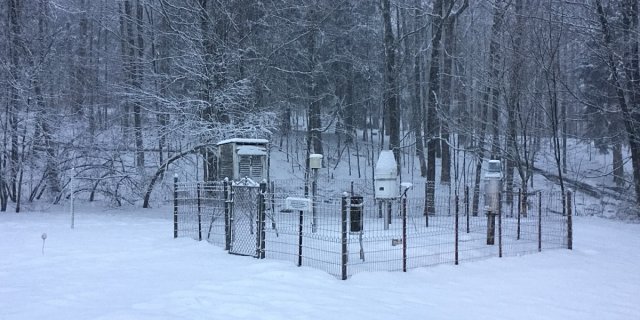
The surplus of rainfall from October nearly wiped out the yearly deficit that had been slowly growing all year long. The months of November and December were drier than normal, which increased the deficit to close out the year. The year was below normal for total precipitation, but was not even close to our two previous very dry years; 2016 was tied as third driest and 2015 was eighth driest. While 2017 as a whole was warmer than normal, the closing months of the year were a little on the cool side. The conclusion of 2017 completes 86 years of continuous weather observations at the Norfolk 2SW weather station.
November’s average temperature of 36.4 degrees was 0.7 degree below normal. Temperatures ranged from a high of 67 to a low of 14 degrees. Precipitation for the month was just 1.20 inches, 3.39 inches below normal. It was Norfolk’s third driest November on record. The driest Novembers were 2012 with 0.84 and 1976 with 1.04 inches. The monthly snowfall of 1.7 inches was 4.9 inches below normal. The first snowfall of the season came on November 7 (Election Day), when we received 0.9 inch of snow. There were no daily temperature records set in November.
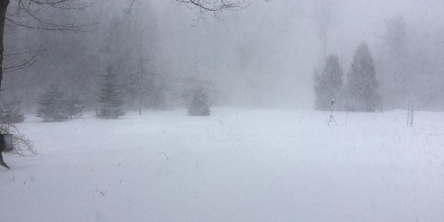
December was even colder. Temperatures ranged from a high of 55 degrees to a low of minus 5. December’s average temperature of 23.0 degrees was 2.7 degrees below normal. This December ranks as Norfolk’s 21st coldest December on record, it tied 1977 and 1983. Below normal for temperature, but not all that impressive. With a total precipitation amount of 2.95 inches, this December was 1.58 inches below normal. December’s monthly snowfall total of 14.7 inches was 2.3 inches below normal. Even with a few days near the end of the month with below zero temperatures, there were no daily temperature records set in December. It has to be really cold to set a low temperature record in late December.
As expected with the colder than normal temperatures, many local ponds started to form ice as early as November 11. The ice went in and out several times in November and early December before finally settling in for the season. Had it not been for a brief warm-up during the first week of December the ice in dates would have been quite early. As it ended up, most of the smaller ponds were iced for the season on December 8 and Tobey Pond and Wangum Lake on December 15. These dates are a few days later than last year, but earlier than most recent years. It was a close one, but a Christmas Eve into Christmas morning snowfall solidified a White Christmas for Norfolk and most of the state.
Norfolk’s weather for 2017 will be remembered as being fairly warm and lacking any major or dramatic weather events. Seven out of twelve months were above normal for temperature and ten out of twelve were below normal for precipitation. Notable months were February for being the second warmest February on record, April for being the fourth warmest April, October for being the third warmest October and November for being the third driest November.
The coldest days of the year did not occur until December 28 and 29 when on both days it was minus 5 degrees. There were only four days in all of 2017 with below zero temperatures, one in January and three in December. There were no days in 2017 that recorded temperatures of 90 degrees or above. The warmest days of the year were May 18 and June 12 with temperatures of 89 degrees. Yes, a little odd that the year’s high temperatures did not even occur during the typical summer months of July and August. The yearly mean temperature was 46.7 degrees, 1.8 degrees above normal. This ranks 2017 as being tied with 1953 as Norfolk’s tenth warmest year on record.
Even with above normal precipitation during two months (May and October) there was a running yearly deficit from January through December. The yearly precipitation amount of 45.83 inches was 6.69 inches below normal, ranking it as Norfolk’s 19th driest year on record.
Snowfall for the 2017 calendar year totaled 68.3 inches, 21.5 inches below normal. February and March were both a little above normal for snowfall, but all other months that typically receive snowfall were below normal. The year of 2017 ranks as Norfolk’s 17th least snowiest year. The 2016-2017 Winter Season (October 2016-May 2017) snowfall total of 88.7 inches was just 1.1 inches below a normal. Had it not been for above average snowfall in November and December 2016 this total would have been considerably lower.

October 2017
Warm and Wet
By Russell Russ
October 2017 was the warmest October on record for all six New England states (as recorded at each state’s official recording location). For many Northeastern US cities, from Newark, New Jersey to Bangor, Maine, it was the warmest October on record and this included Hartford, Bridgeport and Albany. It was Boston’s second warmest on record. It was Norfolk’s third warmest October over the last 86 years.
Norfolk’s beautiful extended late summer-like weather went all through September and well into the third week of October. One could argue that the fall colors may not have been as good as in the past. The colors may have been affected by the lack of cold temperatures, last year’s drought, and possibly a wet leaf-out period in the spring – or all of the above. The peak foliage time is typically around Columbus Day in Norfolk, but this year it was delayed about a week or two.
The month’s high temperature of 74 degrees was observed on October 7, 8 and 22. The low temperature of 29 degrees was observed on October 17. The monthly mean temperature of 54.1 degrees was 6.4 degrees warmer than normal. The top three warmest Octobers for Norfolk are 2001 with 55.3 degrees, 2007 with 54.3 and 2017 with 54.1. Norfolk’s coldest October was in 1974 with an average temperature of 42.0 degrees. There were about seven October days with frost in the area, but only October 17 produced frost at the weather station.
The total precipitation for the month was 8.08 inches, 3.81 inches above normal. The month was running a little below normal until October 29-30 when we received 5.32 inches of rain in about a 24 hour period. Other parts of the state measured 6 inches to even 10 inches from this one storm. The late month storm made this October Norfolk’s sixth wettest October on record. Norfolk’s wettest October was in 1955 with 17.28 inches and the driest was in 1963 with just 0.63 inches.
Through October, the total precipitation amount for the year was 41.68 inches. This is just 1.72 inches below normal. Norfolk’s slowly growing 2017 deficit was nearly wiped out by just this one late October storm. There was no snowfall this month, but measurable snow will be coming to town soon. For the 2017 calendar year through October we are currently 14.3 inches below normal for snowfall.
The big late October rain event seemed to signal a change for Norfolk’s weather. The extended warm and pleasant weather conditions that we enjoyed during September and October finally came to a close. Looking ahead to November, after a relatively warm first week, giving us one last taste of warmth, the temperatures then turned down to be much more typical for November. The first snowfall of the season came on Election Day, November 7, when nearly an inch fell during the early evening hours. Flurries and light snow fell on several other days through mid-month. The low temperature of 14 degrees on November 11 missed a daily record by just 2 degrees.
November is typically the transition into winter for Norfolk and it happened again this year. The leaves are all down, temperatures have gone back to a cool normal, we have seen some snowfall, and it gets dark before 5:00 pm. It is finally time to get ready for winter.

September 2017
Summer Overtime
By Russell Russ
Devastatingly powerful hurricanes and the resulting catastrophic damage affected much of the Caribbean and Florida for a good part of September. The Gulf Coast had its turn in August. Out west there were devastating wildfires. The pictures and stories showed the terrible side of Mother Nature. Here in Norfolk the weather was, for the most part, absolutely beautiful. The weather was so bad in other parts of the country and so nice here that there was almost a feeling of guilty pleasure. Is there such a thing as weather guilt? We should enjoy our good weather while we have it, though, because Norfolk has been on the bad side of Mother Nature and it will be again.
September’s low temperature of 38 degrees was observed on September 2 and the high of 85 degrees was observed on September 25. Strangely, it got warmer as the month progressed, which is not supposed to happen in September. The average mean temperature was 62.1 degrees, 3.2 degrees above normal. There were several days this month with near-record daily high temperatures and three days did set new records. The new records were 85 degrees on September 25 (was 83 in 1970), 83 on September 26 (was 80 in 1970) and 82 on September 27 (was 78 in 2011).
It was the ninth warmest September in the last 86 years. The warmest September was in 2015 with 64.7 degrees and the coolest was in 1963 with 53.6 degrees. In fact, five of the top ten warmest Septembers have occurred over the last ten years. There are twelve years ranked in the top ten warmest Septembers (there were two ties), ten of these twelve years have occurred over the last twenty years.
The month’s rainfall total was 3.48 inches, 1.17 inches below normal. We have been flirting with a slowly growing rainfall deficit all year, but we have received just enough rain to keep things mostly green. In September the deficit grew a little more and the affects became more noticeable. Stream and pond levels dropped and the plants and lawns showed signs of lack of rainfall, especially as the month progressed.
It is not uncommon for Norfolk to receive heavy rainfall from a September hurricane or bigger storm event, but this year it was very quiet. Norfolk’s wettest September was in 1938 with 13.40 inches (thanks to the Hurricane of ’38) and the driest was in 2014 with just 1.16 inches. Through September this year, the total yearly precipitation amount was 33.60 inches. This is 5.53 inches below normal. Last year at this point we were 11.04 inches below normal.
What will October’s weather be like? By two-thirds of the way through the month, the beautiful weather continued. The monthly average temperature was nearly seven degrees above average and the rainfall total was well below normal with just 1.48 inches of rain. There were five days with frost and the frost on October 17 was widespread and killing. Even with some scattered frost and several days with cooler temperatures the incredible extended warmth continues to be the top weather story in Norfolk.

August 2017
Another Beauty
By Russell Russ
August continued our on-going series of months with pleasant weather. Residents along the Gulf Coast and in the Caribbean had a rough weather month, due mostly to Hurricane Harvey, but here in Norfolk, CT the weather continues to be quite nice. Norfolk’s weather for the most part has been very uneventful and fairly nice all summer long. Conditions have been not too hot or too cold and not too wet or even too dry. Hard to complain about the weather around here lately.
The month’s high temperature of 86 degrees was observed on August 22. This was a record high for this date, beating the old 1976 record of 85 degrees. The low of 47 degrees was observed on three consecutive days, August 26, 27 and 28. The monthly average mean temperature was 65.8 degrees, 0.5 degree cooler than normal.
August of 2016 (last year) with an average of 70.2 degrees was the second warmest August on record. In all of 2016 (last year) there were two days at or above 90 degrees at the weather station, which is about average, this year there have been no days at or above 90 degrees. For the record, the warmest August over the last 85 years was in 2001 with 71.0 degrees and the coolest was in 1964 with 61.5 degrees.
The total precipitation recorded for the month was 2.90 inches, 1.73 inches below normal. It was our seventh month this year that was below average for precipitation, but it is important to note that unlike our previous two years, this year’s monthly deficits have not been at extreme levels.
Through August, the total precipitation amount for this year was 30.12 inches. This is 4.36 inches below normal, but does not come close to our previous two years of deficit figures. Norfolk’s wettest August occurred in 1955 (of course) with a monthly total of 23.67 inches, thanks to Hurricanes Connie and Diane. The driest August was in 1953 when only 0.65 inches was recorded.
What will September’s weather bring to Norfolk? Through mid-month for the most part the nice weather continued to bless Norfolk. Temperatures were running about normal with no extreme hot or cold temperatures. Rainfall was a little above normal. Several devastating Hurricanes have made landfalls in the Caribbean and in Florida. This year has been exceptionally devastating as far as hurricanes go. Not only have the hurricanes made direct hits, they have also been exceptionally strong this season. Fortunately, Connecticut continues to stay out of the path of these storms. Beneficial rainfall is welcome. Getting several months’ worth, or even an entire year’s worth, of rainfall from one storm is certainly not welcome.

July 2017
Another Fairly Normal Weather Month
By Russell Russ
July was yet another fairly average month for weather in Norfolk. Except for a few warmer than normal average monthly temperatures during the months of January, February and April, all other months this year have been very average for both temperature and precipitation. Other regions of the country (and world) are still recording weather extremes, but Norfolk appears to be in a bit of a nice happy medium for weather. Things can always change weather-wise so enjoy the pleasant weather while it lasts.
July’s high temperature of 86 degrees was observed on July 20 and the low temperature of 50 degrees was observed on both July 26 and 30. With an average monthly mean temperature of 68.2 degrees, it was just 0.1 degree above average. We still have not reached the 90 degree mark this year at the weather station. July 2013 with a monthly mean temperature of 72.7 degrees was Norfolk’s warmest July. The coolest July was in 1962 with a temperature of 63.9 degrees.
The total precipitation recorded for the month was 3.89 inches, 0.45 inches below normal. Something that was a little unusual for July was the fact that not one thunderstorm was observed at the weather station during the month. Norfolk is getting a fair amount of rain, but the big storms and severe weather have not been making a direct hit on the station.
Through July the total precipitation amount for the year was 27.22 inches. This is 2.63 inches below normal. We are below normal for the year so far, but we are in much better shape than the last two summers. Last summer we were nearly nine inches below normal and the year before that we were over four inches below normal. The lawns have enjoyed the moisture and have looked nice and green this summer, but the trees are still suffering from the previous two years of drought. Many trees, especially the maples and ash continue to struggle and have even begun to turn color earlier than usual.
An early look at August shows that it was seasonably warm with several hazy, hot and humid days to start off the month. Through the first half of the month we continued to see typical summer weather, still not reaching 90 degrees for a high temperature. Rainfall was a little below normal, but a good summer thunderstorm could change that quickly. Autumn is just around the corner.

June 2017
A Fairly Normal June
By Russell Russ
June’s low temperature of 40 degrees was observed on June 3 and the high of 89 degrees was observed on June 12. With an average monthly temperature of 64.1 degrees, it was 0.8 degree above normal. There were two daily records set this month. The 89 on June 12 just beat out the 1933 high of 88 and the high of 88 on June 13 just beat out the 1984 high of 87.
This June was fairly average for temperatures. The coolest June was in 1958 with an average temperature of 58.8 degrees. The warmest June was in 1943 with 68.3 degrees.
The total precipitation recorded for the month was 4.54 inches, 0.32 inch below normal. There were four thunderstorms this month. On June 19 there were two waves of afternoon storms, both with heavy rainfall that totaled 2.43 inches in a short period. Norfolk is getting its share of summer thunderstorms this year, but so far nothing has been overly severe.
This June was also fairly average for rainfall. The driest June was in 1988 when only 0.74 inch was recorded. Our wettest June was in 2013 with 13.38 inches.
For the first half of 2017 our total precipitation amount was 23.33 inches. The deficit for the year so far is 2.18 inches. We are a little below normal this year, but we are in much better shape now than we were during the last two years.
The rainfall deficit has not been a concern this summer, but the deficits from 2015 and 2016 have affected the trees. Many maples and ash have thin and slightly browning crowns this summer. It typically takes trees a year or two to show signs of drought damage and over the last month the signs have become quite noticeable. Hopefully our fairly average rainfall this summer will relieve the stress on our trees so they can rebound without any lasting damage. At least we do not have widespread gypsy moth caterpillar damage like many other parts of Connecticut are seeing.
An early look at July shows that through mid-month it was about typical. July is on average Norfolk’s warmest month of the year. We are supposed to see hazy, hot and humid conditions in July and we have had some of that. The weather station typically gets to 90 degrees or above two to three times a year, but so far this year we haven’t reached that point. The highest temperature recorded at the station this year has been 89 degrees, once in May and once in June.

May 2017
Beneficial Rainfall
By Russell Russ
May’s weather was not the most pleasant. Following a much warmer than normal and very spring-like April, May was mostly cool, cloudy and wet. On the plus side, May did bring much needed rainfall to the area. It was the first month since February 2016 where the monthly precipitation amount was above normal. Norfolk is still carrying a rainfall deficit for this calendar year, and the running two year deficit is still a concern, but perhaps May has turned the tide and we will finally be making some progress in the rainfall department.
May’s low temperature of 30 degrees was observed on May 9 and the high of 89 degrees was observed on May 18. The first half of the month was much cooler than normal, but a mid-month warm spell with a couple of record breaking days changed that. The May 17 high of 87 degrees surpassed the old 1974 record of 83 and the May 18 high of 89 surpassed the 1962 high of 86. The high of 84 degrees on May 19 was a few degrees shy of a record.
With an average monthly mean temperature of 53.2 degrees, the month ended up being 1.7 degrees cooler than average. It was cool, but May’s temperature was nowhere near any record. It was however the coolest May since 2008. The coolest May on record was in 1967 with 46.8 degrees. The warmest May was in 2015 with 61.8 degrees.
May’s total precipitation amount of 5.61 inches was 1.26 inches above normal. Norfolk’s driest May was in 1980 with 1.31 inches and the wettest May was in 1984 with 12.34 inches. Through May this year our total precipitation amount was 18.79 inches. This is still 1.86 inches below normal, but the yearly deficit was decreased this month.
A brief burst of morning snow and snow showers throughout the day on May 8 brought just a trace of snowfall. Snow might not be welcome in May, but it does happen fairly regularly in Norfolk. Even with this brief snowfall, May’s monthly snowfall was still 0.4 inch below normal. The 2016-2017 winter season snowfall amount ended up being just 1.1 inches below normal. The winter was fairly average for snowfall, but we are running 13.4 inches below normal for snowfall for the 2017 calendar year.
A look ahead to June’s weather shows that the month began much like May did, much cooler than normal and quite cloudy and wet. A mini heat wave with a couple of record setting warm days June 11 to 13 will certainly bring up the month’s temperature average. Rainfall was about average through mid-month. June might not go down as being the most pleasant weather-wise, but summer had definitely arrived and the looming rainfall deficit’s grip seems to be loosening.

April 2017
Fourth Warmest April on Record
By Russell Russ
April began with six inches of snow on the ground and most local lakes and ponds still covered with ice. Maple sap was still flowing and syrup was still being produced. By April 5, both the snow and the ice were gone and the maple syrup season was over. Temperatures quickly became warmer than normal and stayed that way throughout the remainder of the month. Snowfall and rainfall were below normal, but both were not far below normal. Spring came in April.
Unlike last year, when some unseasonably cold April temperatures hurt certain flowering trees and shrubs, there were no hard freezes this year to cause much damage. Blooming time and abundance was about normal this year, much better than last year.
April’s low temperature of 26 degrees was observed on April 9 and the high of 84 degrees was observed on April 11, just two days later. There were two daily-record high temperatures this month: April 10, with 78 degrees, surpassed the old 1945 record of 75 degrees; and April 11, with 84 degrees, surpassed another 1945 record of 78 degrees.
With an average monthly mean temperature of 48.4 degrees, it was 5.3 degrees warmer than normal, making this April Norfolk’s fourth warmest over the last 86 years. The warmest April was in 2010 with an average mean temperature of 49.4 degrees and the coldest was in 1943 with 36.8 degrees. April’s average monthly temperature has not been below 40 degrees since 1978.
The total precipitation recorded for the month was 3.76 inches, 0.47 inches below normal. Through April, our total precipitation for the year was 13.18 inches, 3.12 inches below normal. The precipitation deficit still continues to grow, but it is slowing down and is not a major concern at this time.
April’s snowfall total was 1.4 inches, 4.5 inches below normal. The month began with six inches of snow on the ground, but that was all gone by April 5. The 2016-17 winter season snowfall total was 88.7 inches. This was just 1.1 inches below normal, so it was very much a typical winter for snowfall. Last winter the snowfall total was a record-setting 35.5 inches, the least amount on record.
An early look at May’s weather through May 15 shows that temperatures were running seven degrees cooler than normal. There was even a brief burst of snow followed by snow showers on May 8, but despite the month’s cool start, the unseasonably warm spell that occurred May 17 to May 19 will certainly bring up the average. Rain fell in greater than usual amounts, and we had nearly reached May’s monthly rainfall average by mid-month. This will provide some relief from the rainfall deficit that we have recently been facing.
March 2017
Back to winter
By Russell Russ
With February’s record warmth, you would have thought March would follow suit and spring would be just around the corner. The first day of March was warm, the warmest day of the month actually, but it was back to winter after that. There were some nice early spring days, but a majority of the month was cold. Most local lakes and ponds had lost their ice in late February only to get it back again in early March. The larger lakes began opening up late in the month, but Tobey Pond and many other smaller ponds stayed ice covered into April.
March is typically the big maple syrup producing month in Norfolk, but this year it was too cold for sap flow during a good portion of the month. In the end, it turned out to be about an average maple syrup year in Norfolk. The top story of the month was the blizzard that hit on March 14. Snowfall depths ranging between 14 and 22 inches were reported in the Norfolk area. Conditions were bad with much blowing and drifting, but forecasts were for more snow than we actually received, so it could have been worse.
March’s high temperature of 59 degrees was observed on March 1 and the low of 1 degree was observed on March 5. With an average mean temperature of 27.7 degrees, it was 3 degrees colder than normal. There were no daily record highs or lows. It was the sixteenth coldest March over the last 86 years.
The total precipitation for the month was 3.20 inches, 1.23 inches below normal. Not record setting, but it did add to our slow growing yearly deficit. Through the first quarter of 2017 the total precipitation amount was 9.42 inches, 2.65 inches below normal.
The monthly snowfall total was 21.2 inches, 3.7 inches above normal. Interestingly, there was no snow on the ground until March 10. The blizzard on March 14 produced varying snowfall amounts. The total blizzard snowfall at the weather station was 15.9 inches over two days, but there were people that reported up to 22 inches in and around Norfolk. The blizzard contained heavier snow bands, much like summer thunderstorms, and it depended where the heavier bands happened to hit. Had it not been for this one storm, March’s monthly snowfall would have been well below normal.
Unlike last year, which was the least snowy winter season on record, this winter season, October through March, was just about normal. Through March, this winter’s snowfall amount was 87.3 inches, 3.8 inches above normal.
An early look at April showed it to be fairly normal through mid-month. Most area ponds had lost their ice for the season by April 5. The early February warmth had pushed budding and blooming a little ahead of schedule, but a cool March kept things in check. Spring really is now just around the corner and it will not be long until everything greens up once again. Enjoy the early warm days before the blackflies come out, but watch out for ticks who are already here.

February 2017
Second Warmest February on Record
By Russell Russ
The month began with all ponds being iced over, 5 inches of snow on the ground, cold temperatures and then several days with snowfall. Through mid-month temperatures were running about 5 degrees below average for February and we had already received our average snowfall amount for the entire month. Winter had arrived. The latter part of the month was a completely different story with barely a trace of snowfall, very warm temperatures and even a thunderstorm on February 25. There were five days during the last week of the month that set records for daily high temperatures. The snow was all gone and the ponds were free of ice by the close of the month. Spring had arrived.
The month’s low temperature of 5 degrees was observed on February 10. The high temperature of 67 was observed on February 24. The average monthly mean temperature was 30.2 degrees, 8.3 degrees above normal. It was the second warmest February over the last 86 years. Daily record highs: 55 on February 22, 62 on February 23, 67 on February 24, 60 on February 25 and 57 on February 28. The warmest February on record was in 2002 when the monthly mean temperature was 30.7 degrees. For comparison, the coldest two months (of any month) on record for this station are February 1934 with 9.0 degrees and February 2015 (just two years ago) with 10.9 degrees.
The total precipitation recorded for the month was 2.69 inches, 0.94 inch below normal. The 2017 calendar year, January and February, total precipitation amount of 6.22 inches is 1.42 inches below normal. The ongoing drought continues to slowly get worse.
The monthly snowfall total of 20.8 inches was 0.2 inch above normal. It did not seem like it snowed much, but it did – it just all came during the first half of the month. The 2017 calendar year snowfall total of 29.3 inches is 12.2 inches below normal. The snowfall total for this winter season, October through February, is 66.1 inches, just 0.1 inch above normal. We would be considerably more below normal for snowfall had it not been for a fairly snowy November.
A look ahead to March shows that winter was in fact not done yet. After two near record warm days to start the month it quickly turned cold. Halfway through March, temperatures were running nearly 6 degrees cooler than normal with many nights dipping down into the single digits. Early March was cold, but relatively snow free until the March 14 blizzard hit. The weather station recorded nearly 16 inches, but many other locations in the area saw depths ranging from 14 to 24 inches. The big nor’easter with its heavy snow bands produced some varying snowfall totals. With multiple single digit mornings, many ponds icing over again and then the heavy snowfall with much blowing and drifting, many wondered where our early spring had gone. By mid-March the monthly snowfall amount was already nearly 3 inches above normal. The maple syrup makers may have gotten a good jump on the season in mid-February, but Mother Nature put a hold on the syrup business during February’s late month warm spell and again during early March’s cold spell.
