
PREVIOUS WEATHER REPORTS

December 2013
Norfolk’s December Weather and a Yearly Summary for 2013
By Russell Russ
Up to the third week of the month it looked like we would have a colder than average December. A few warm days just before Christmas, including two back to back record warm days, changed all that. The high of 59 degrees on December 21 beat the old 1973 record of 53 degrees and the high of 62 on December 22 beat the old 1990 record of 58. Temperatures went back to normal from Christmas through the end of the month.
The monthly average temperature of 27.5 degrees was 2.1 degrees warmer than normal. The month’s low temperature of minus 2 degrees was observed on December 17 and the high temperature of 62 degrees was observed on December 22.
December’s total precipitation amount was 3.96 inches, 0.56 inches below normal. The monthly snowfall total of 15.8 inches was 1.5 inches below normal. With eleven inches of snow on the ground on December 18, a white Christmas seemed a given. It turned out that a very light dusting of snow on Christmas Eve was all that contributed to a barely white Christmas. The snowfall total for the winter season, October through December, was 17.5 inches, 7.3 inches below normal.
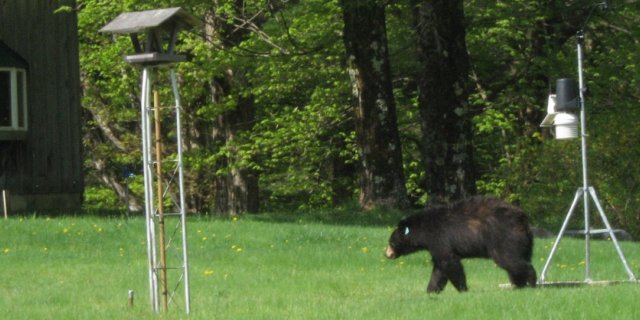
Many smaller ponds in the area initially iced over in late November. Most went out around December 24, only to ice over again on December 25 or 26. Tobey Pond and Wangum Lake were iced over quite early (on December 13), but lost it on December 24. They both iced over for the season on December 26, about a week earlier than last year.
In review of Norfolk’s weather for the 2013 calendar year, it was a little warmer than normal, a little wetter than normal and a little less snowier than normal, but all in all not too far from average. With an annual average mean temperature of 45.9 degrees it was 1.1 degrees above normal. Eight of twelve months in 2013 were above normal for temperatures. July was our warmest month of any month that we have recorded in 82 years.
With a total precipitation amount of 54.80 inches, the year 2013 was 1.93 inches above normal. June was our wettest June and fifth wettest month of any month on record. The yearly snowfall amount of 71.3 inches was 20 inches below normal. Our trend of warming with less snow and more rain continued throughout 2013.

November 2013
Colder than average (again)
By Russell Russ
Not easy to find a colder than average month these days, but November 2013 was just a bit colder than the average November. Many smaller ponds, including Tamarack, McMullen and Pond Hill, iced over on November 24. They opened up on November 27, but iced over again on November 28. Tobey Pond and Wangum Lake were about 50% iced over as of the end of the month. It sure felt like a cool, cloudy and wet month, just like November is famous for. If November is the telling month for the coming winter then we may be in for a cold and wet one.
The month’s high temperature of 63 degrees was observed on November 1 and the low temperature of 9 degrees was observed on November 30. Interesting to note that the high was on the first day of the month and the low was on the last day. The average mean temperature was 35.3 degrees, 1.8 degrees below normal. There were no daily temperature records set this month, but it was the coldest November since 1997, just beating 2012 by 0.1 degree. You have to go back to 1997 to find a colder November than we just had. We have had two colder than normal Novembers in a row now. Does this mean our warming period is over? Only time will tell.
The total precipitation for the month was 4.69 inches, 0.47 inches above normal. Over half of the monthly rain came during one storm on November 26-27. Through November this year, the total precipitation amount was 50.84 inches. For the first eleven months of the year we were 2.49 inches above normal for this time period. With still one month to go until year’s end it is looking like a fairly normal year as far as precipitation goes.
The month’s snowfall total was just 1.7 inches, 4.9 inches below normal. Through November, the yearly snowfall amount for 2013 was 55.5 inches, 18.5 inches below normal for this time period. Even if December comes in with an average amount of snowfall it is looking like 2013 will be nearly 20 inches below normal for the year. Our yearly average snowfall amount is 91.3 inches.

October 2013
A calm weather month
By Russell Russ
With little rain, no big storms and just a touch of cold air it was rather warm and mostly dry this month. After last October’s affects from Hurricane Sandy and nearly two feet of snow the October before that it was a nice to be treated gently by Mother Nature this year. September brought a few scattered frosts to the area, but the first frost at the weather station didn’t occur until October 23, ten days later than last year’s first frost. As usual the foliage peaked in color about the second week of the month.
It is usually nice to have some great Norfolk weather event to report on, but the story this month was that there was no big weather story. Actually, the entire 2013 fall season has been eerily quiet. Have no fear, we live in New England so our next big weather event is probably just around the corner.
The month’s high temperature of 72 degrees was observed on October 4 and the low temperature of 28 degrees was observed on October 30. The average mean temperature was 50.0 degrees, 2.4 degrees above normal. Temperature-wise it was very similar to last October.
The total precipitation for the month was 1.52 inches, 2.79 inches below normal and 4.63 inches below last October. The first observed flurries of the season came during the early morning hours of October 25. There was a little sleet and snow mix early on October 30 as well. The month’s snowfall total came to just a trace. The average snowfall amount for October is 0.9 inches.
Through October, the total precipitation amount for the year was 46.62 inches. Over the last two months we have decreased our rainfall surplus for the year, but through October, thanks to a wet summer, we were still 2.96 inches above normal.

September 2013
Beautiful Autumn Weather
By Russell Russ
Autumn treated us well this year. After a wet start it turned quite warm then transitioned into a nice two week stretch of nice fall weather. There were three, maybe four or five, scattered frosts in the area this month, but none were observed at the weather station. The growing season went relatively unscathed throughout the month. The fall colors were nice as usual. Maybe not the best ever and arguably they started just a bit sooner than in recent years. It was hard to complain about the weather this month.
The month’s high temperature of 89 degrees was observed on September 11. The low temperature of 37 degrees was observed on September 17. The average mean temperature was 57.9 degrees, about one degree cooler than normal and about two degrees cooler than last September. The 89 degrees on September 11 tied the 1983 record for that date.
The total precipitation for the month was 4.27 inches, 0.45 inches below normal. Most of the month’s rainfall came on just four days, leaving the rest of the month relatively dry. There were four thunderstorms observed this month with two coming on one day. The one that came through during the early morning hours of September 1 was particularly powerful with vivid lighting and numerous cloud to ground strikes. Unlike some recent years we had no big late in the month rain or wind events to prematurely strip off the highly prized fall foliage.
Through September this year, the total yearly precipitation amount was 45.10 inches. This is 5.75 inches above normal through the month of September. No snowfall to report on this month, which is normal for us, but stay tuned over the coming months, many preliminary reports suggest it might be a cold and snowy winter.

August 2013
Summer ends on the cool side
By Russell Russ
The summer season came to a close with August’s exit. It was not the greatest summer month on record by far and not as nice as August 2012, but all in all you could not call it too bad. It was cooler than normal and nearly two inches wetter than normal, but looking back, it did not seem overly rainy even though it did have some bad timing with rain on weekends. There was a nice string of twelve days in the middle of the month that were very pleasant. We made it through summer just about average for days at or above 90 degrees. We had two days in July with 90 degree temperatures. According to the National Weather Service, for the first time since 2002 there were no named hurricanes formed by the end of the month.
The month’s low temperature of 47 degrees was observed on August 15 and the high temperature of 83 degrees was observed on August 28. There were no daily temperature records this month and surprisingly only three days with temperatures in the 80’s. The average mean temperature was 65.7 degrees, 0.5 degrees below normal and 3 degrees below last August’s average.
The total precipitation for the month was 6.63 inches, 1.99 inches above normal. It was our fourth month out of eight this year that we have been above normal for precipitation. There were three thunderstorms observed at the weather station this month and none were particularly strong. Even though we had no hurricane affects and no big thunderstorms we did still get smacked by a heavy rain storm on August 9. Our daily total from that one storm was 3.78 inches and a majority of that came in about a three hour span. Other towns in the state got even more than us. We picked up another 1.45 inches in a storm late August 26 to early August 27. Those two rain events put us over our normal monthly rain total.
Through August this year, the total precipitation amount for the year was 40.83 inches. This is 6.20 inches above normal and 14.26 inches more than through August last year. Anyone notice how nice our lawns looked all through summer this year? They might have needed some extra mowing, but they sure were green.

July 2013
Warmest Month on Record
By Russell Russ
July 2013 was a record breaker. Many locations throughout the Northeast recorded their warmest months on record. We heard that after July 2012 as well, but at that time Norfolk had only recorded its seventh warmest month. Norfolk was not to be left out this year and came in with its warmest month, since 1932 anyway. Stamford, Bridgeport, Middletown, Hartford and Providence all recorded monthly average record highs, all in the upper seventy degree range. Norfolk’s average monthly temperature in July didn’t even break 73 degrees, but it was still good enough to be our new warmest month. We can thank our forested landscape and our elevation for playing a huge role in keeping our temperatures lower here compared to our big city neighbors.
The month’s high temperature of 90 degrees was observed on both July 18 and 19. These were the first days we reached 90 or above in 2013. The month’s low temperature of 53 degrees was observed on July 25. There were no daily temperature records this month, but we were within a couple of degrees on five separate days. Many other Connecticut locations were similar in this regard. The main reason why we all made the warmest month with few or no daily record highs is that the nights did not cool off as they typically do.
The monthly average mean temperature of 72.7 degrees was 4.7 degrees warmer than normal for July and now holds the distinction of being the warmest month in our 979 month history. Norfolk’s other warmest months have also been in July and they were 1955 with 72.1, 2006 and 1935 with 71.7, 2010 with 71.5 and 1949 with 71.3 degrees.
The total precipitation for the month was 3.80 inches, 0.49 inches below normal. After June being 8.59 inches above normal I think we can handle being a little below this month. There were six thunderstorms observed at the weather station this month, but none were particularly powerful.
Through July this year, the total precipitation amount for the year was 34.20 inches. This is 4.21 inches above normal for this period. Through July we were 1.56 inches off pace from 2011, our wettest year on record.

June 2013
Wettest June and Fifth Wettest Month on Record
By Russell Russ
We all thought May was a wet month. Well, it was, but June came in and nearly doubled May’s rainfall total. It was the wettest June and the fifth wettest month of any month in the last 82 years here in Norfolk. The previous June record was topped by June 19 and the rain continued through the end of the month. Typically June will have a couple of days with an inch or two of rain and the rest will come here and there in smaller amounts. Not the case this month which had seven days where rainfall was nearly one inch and even up to two and a half inches. When it rained it poured.
This year started out dry. At the end of April we were 6.50 inches below normal. At the end of May the deficit was 3.89 inches. Through June the total precipitation amount for the year was 30.40 inches and we went from a deficit of 3.89 inches to a surplus of 4.70 inches. No drought conditions here this summer.
With 13.38 inches of rainfall, this June is now our wettest June on record. It is followed by 1986 with 10.41 inches, 2009 with 9.53 inches and 1972 with 9.22 inches. This month was an impressive 8.59 inches above normal for rainfall. There were four days when thunderstorms were observed. One day alone had four pass through town. While the thunderstorms did bring heavy rain, the big story was the persistent tropical showers that came mostly without thunder and lightning. Many of these showers dumped large amounts of water in short periods of time. They were scattered downpours, but if you were in one you certainly knew it.
The month’s high temperature of 88 degrees was observed on June 1 and the low temperature of 44 degrees was observed on June 5. The average mean temperature was 64.9 degrees, 1.6 degrees above normal. There were numerous days in the mid to upper eighties, but no daily temperature records were broken. We have come close a few times, but the weather station still has not yet recorded a temperature at or above 90 degrees this year. Typically, we hit 90 or above two to three times a year. The all-time record for the weather station was 101 degrees set back on June 29, 1933.
May 2013
It was a wet one
By Russell Russ
May picked up right where late April left off, giving Norfolk some beautiful weather. From mid-April to May 7 it was clear and dry with pleasant temperatures. The lovely weather ended May 8 when the rains began.
Spotty frost in the area was reported on May 5, 6, 13, 14, 15, 26 and 27. With eleven days in the 30’s and only a few days in the 80’s you would think it was much cooler than normal, but it was actually a little above average for temperatures. Memorial Day was pleasant, and then it started to heat up at the end of the month. The gardener’s mantra of not planting too much before Memorial Day certainly made sense this year.
May’s low temperature of 33 degrees was observed on May 6, 14 and 15. The high of 89 degrees observed on May 31 was a record for that date, beating the old record of 88 set back in 1937. We just missed record high temperatures on both May 21 and May 30. With an average monthly temperature of 56.4 degrees, it was 1.7 degrees above normal.
While the month started out nice and dry, almost too dry, it certainly did not end that way. The total precipitation recorded for the month was 6.95 inches, 2.61 inches above normal. There were seven thunderstorms observed this month with a few on the strong side.
A tornado warning on May 21 got everyone’s attention, but thankfully we only saw some brief small sized hail and no tornado came to town. Strong winds associated with multiple storms during the evening of May 29 knocked down trees and wires, hitting the north side of town especially hard. No snow or sleet fell during the month, so we ended the month of May 0.4 inches below normal for snowfall.
We were 6.5 inches below our normal yearly total precipitation amount at the end of April, but we gained some ground on this in May. For the 2013 calendar year through May our total precipitation amount of 17.02 inches was 3.89 inches below normal.
And then came June. That precipitation deficit quickly shifted to a surplus. As of June 19, June of 2013 was already the wettest June since we began observations in 1932. With a rainfall amount through June 19 of 10.71 inches, the monthly average of 4.79 inches was shattered, topping the old record of 10.41 inches set back in June of 1986.

April 2013
Transition into springtime complete
By Russell Russ
Our April began with cool temperatures, ice on many ponds, snow on the ground and maple sap continuing to flow. Things began to change after the first week of the month. The maple syrup season came to a close, the ice went out on the local lakes and ponds and the temperatures slowly began to rise. Tobey Pond and Wangum Lake lost their ice for the season on April 9. This was nearly a month later than last year, but just about average. Our last trace of snow was gone by around April 12 and from then to the end of the month our early flowers and blooming shrubs came out and everything began to green up once again. Another winter is behind us and spring finally arrived in Norfolk. Unlike last year’s incredible early warmth, this year was pretty much normal and right on schedule.
April’s low temperature of 23 degrees was observed on both April 2 and 3. The high of 72 degrees was observed on April 24. With an average temperature of 43.3 degrees it was just 0.2 degree above normal. There were no temperature records set this month.
The total precipitation recorded for the month was 1.70 inches. It was our seventh driest April in the last 82 years. Through April our total precipitation for the year was 10.07 inches. We are down 6.5 inches in just four months so early 2013 has definitely been on the dry side. April’s snowfall total was just 0.2 inches. This was six inches below normal, but it is fairly common to have no snowfall or just a very little in April. We are most likely done with snow for the season, but light snow or flurries can occur during May here in Norfolk.
It is not looking like this May will have any snowfall so here are the figures through the end of April. For the 2013 calendar year the snowfall total is now at 53.8 inches, 12.3 inches below normal for this time period. Our 2012-2013 winter season snowfall total was 75.7 inches, about 15 inches below normal, but not record setting in any way. For the record, the first frozen precipitation was observed November 2 and the last was on April 14. We did have a decent snowpack this winter, but our rain and snowfall deficit may prove troublesome as we head later into the year.

March 2013
Still felt like winter
By Russell Russ
Did you think it was a cold March this year? Many people did. Where were all those 70 degree days? Well, it was a cooler March than we have experienced in a while. It was the coldest March since 2005. Other years with colder Marches than this year were 2001 and then 1996 before that. You have to go back to the early 1990’s to find a few in a row that were as cold as or colder than this year. It was March after all and here in Norfolk it is supposed to get cold in March. Maybe we are getting soft here in the Icebox of Connecticut when the usual normal feels cold.
Last year was the warmest March on record for us and with an average temperature of 41.8 degrees it was an impressive 12 degrees warmer than this year. The month of March is typically our transition month into spring, but unlike last year, spring was mostly held in check throughout the entire month. At month’s end, many warmer locations around town may have lost most of their snow cover, but at the weather station there was still a solid eight inches on the ground. Many local ponds still had enough ice to safely walk on at the end of the month.
March’s low temperature of 8 degrees was observed on March 18 and the high of 51 degrees occurred on March 31. The 50 degrees recorded on March 10 was the only other time it reached 50 or higher. With an average temperature of 29.7 degrees it was 0.9 degree cooler than normal. There have been many years where we have recorded below zero temperatures in March. Not this year, in fact, this year we only dipped into the single digits once. Unlike last year when the temperatures were often too warm for the maple sap to flow, this year there were many days when it was just too cold for it to flow.
The total precipitation recorded for the month was 2.63 inches, 1.91 inches below normal. The 2013 calendar year total precipitation amount of 8.37 inches is 3.87 inches below normal. The monthly snowfall total was 19.8 inches, 1.6 inches above normal. Our snowfall was fairly evenly distributed throughout the month with the largest snowfall coming on March 7 and 8. The 2013 calendar year snowfall total of 53.6 inches is 6.3 inches below normal. The snowfall total for this winter season, October through March is 75.5 inches, 9.2 inches below normal for this time period, but it is 20 inches more than last year.
